Wettest Start To December In Bay Area History: 736% Of Normal Rainfall In San Jose, 424% In San Francisco
SAN FRANCISCO (KPIX 5) -- If you're thinking, "It's never rained like this in December before", you are absolutely right. As of Wednesday night, this is the wettest start to a December in Bay Area history, with weather records dating back to before the Civil War.
San Jose is already #2 on the all-time wettest December list with 7.44 inches of rain. Put another way, the Bay Area's most populous city has received 736 percent of its average December rainfall. Oakland (455 percent) and San Francisco (424 percent) aren't that far behind.
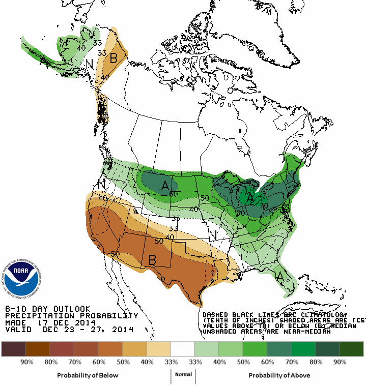
Higher pressure will begin heading in our direction starting Thursday, and after some light rain on Friday, the Bay Area will dry out for at least 5-7 days. This map from the Climate Prediction Center (CPC) shows the rainfall outlook through the end of the month. The brown colors denote a prediction for below-average precipitation.
Many of you have e-mailed me asking about the rest of the winter. I'll start with January. Interestingly, three of the wettest Decembers (10.70"+ rain) on record have happened in San Francisco since the year 2000. I looked back at the weather records to see what happened in the months that followed those soggy Decembers. Each time, we had BELOW-AVERAGE rainfall in January and February. Only once, the 2005-06 water year, did we end up with significantly more winter rain than what is expected. There's no correlation to this winter, but I found it interesting nonetheless.
Many different computer forecast models try to predict the weather months in advance. All of these predictions need to be taken with a grain of salt, but one that I look at on a regular basis is the one pictured below.
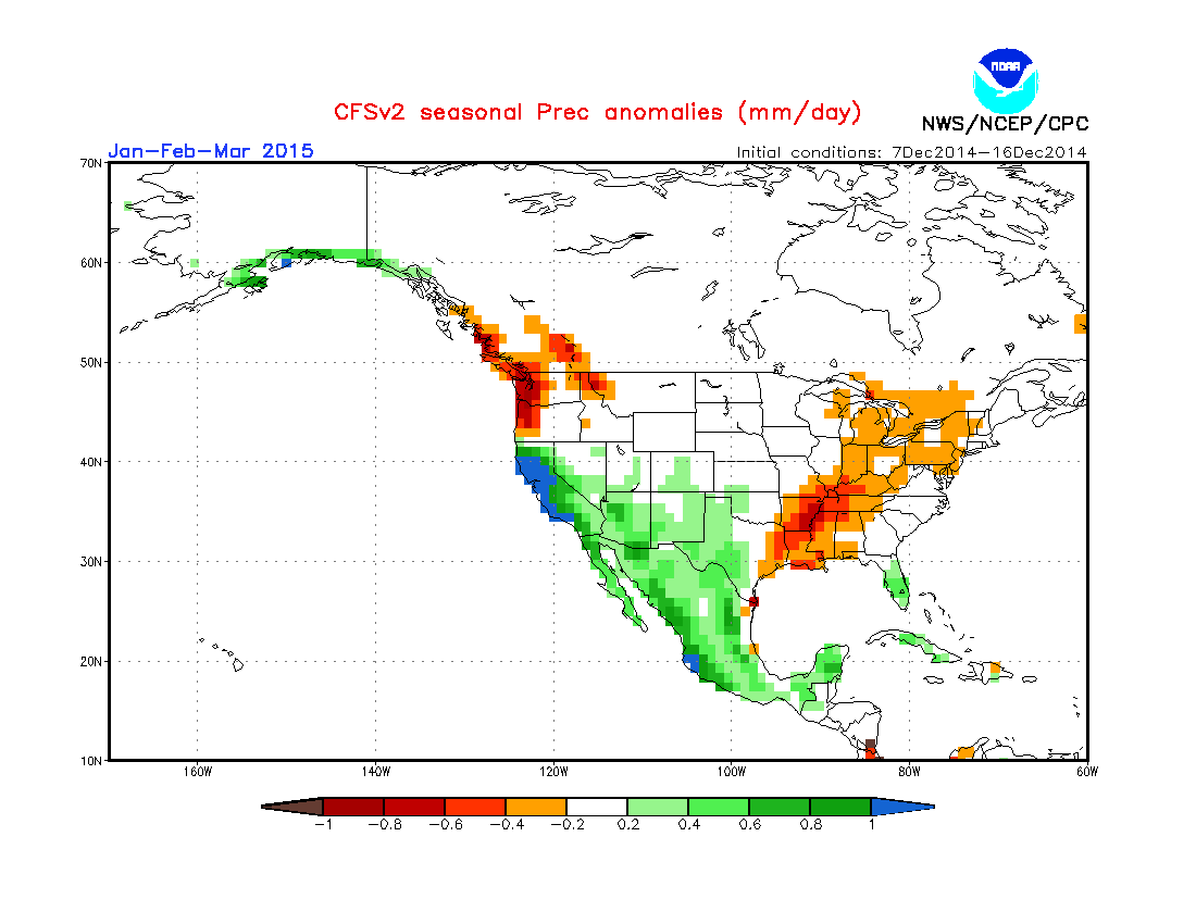
This particular forecast model peers all the way out six months and beyond. The snapshot above shows its prediction for JFM, or "January, February, March". For several months, the CFSv2 model has predicted a wetter-than-average (the green & blue color) early 2015 for most of California. It also predicted a very wet December, so although there are differing opinions when it comes to computer models, this one has been on a hot streak recently. It's no guarantee, but I'm leaning toward wetter-than-average conditions to return sometime in January.
Even if we were to get "normal" rainfall (and mountain snow) for the rest of the winter, this would be one of the wettest water years that we have had in the Bay Area in a decade. After three straight extremely dry winters, that is music to water manager's ears.
CONTINUING STORM COVERAGE: